
Land Assembly and Access in Selby
Some sites in Selby cannot be developed alone because another owner controls the way in. That might be a ransom strip, a verge, land needed for visibility at a junction, or a private lane. Land to Homes investigates title and highway records, then works with each party to agree access on fair, written terms.
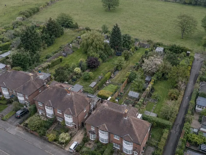 Selby · YO8
Free site appraisal
Tell us about your land and we will call you back. No cost, no obligation.
Prefer to talk? Call 0800 088 6248.
- Free site appraisalNo cost, no obligation
- Legal fees coveredReasonable fees, on options and promotion
- Nothing to pay upfrontOn promotion: we fund planning
- Direct purchaseSuitable sites, with or without planning
- UK-wideEngland, Wales, Scotland and NI
Selling land around Selby
Selby (YO8) is one of the North Yorkshire towns we cover, about 12 miles south of York. Goole is the closest neighbouring place we cover, at about 10 miles, followed by Pontefract and York. Within England, Selby falls in the Yorkshire and the Humber region.
Typical sites we review near Selby include large and long rear gardens, redundant commercial buildings and small holdings and pony paddocks. In England, where Selby sits, planning decisions are made by the local planning authority, usually the district, borough, city or unitary council (or a national park authority).
Send us a postcode in or near YO8 and we will start with a free desktop appraisal.
Why work with Land to Homes in Selby
Unregistered land traced
Some strips and verges have never been registered. We search the records and, where an owner cannot be traced, explain the options, which usually need specialist legal advice.
Highway boundaries checked
The adopted highway does not always reach your boundary. We ask the highway authority for its records, because a narrow unadopted verge can change the access position completely.
Equalisation between owners
A collaboration or equalisation agreement shares proceeds by area or agreed proportion, so it does not matter whose land ends up as roads, open space or homes in the final layout.
Ransom strips identified
A ransom strip is land that controls access to a development site. We check titles and highway records to establish who owns every piece of land between your site and the public road.
How the rules work in Selby
Land with no planning permission can still be sold. Around Selby, the usual routes in England are a direct sale, an option agreement or a promotion agreement, where the planning work is funded for you and the land is sold once consent is granted. Outline planning permission settles the principle, with reserved matters approved later. Section 106 obligations, the Community Infrastructure Levy where charged and biodiversity net gain all affect what a site is worth, so independent advice matters.
In England, new estate roads are usually adopted under a Section 38 agreement with the highway authority, with works to the existing road under a Section 278 agreement. Ownership is checked through HM Land Registry and local records. Where a Local Plan allocates a larger site across several ownerships, it may require a masterplan covering all of them.
| Local planning document | Local Plan |
|---|---|
| In-principle consent | Outline planning permission, with reserved matters approved later |
| Land registration | HM Land Registry |
| How a sale becomes binding | A land sale becomes legally binding on exchange of contracts and finishes on completion, after which the buyer registers the title with HM Land Registry. |
Questions about Land Assembly and Access in Selby
What is an equalisation agreement?
It is an agreement between landowners whose land will be developed together. It shares proceeds and costs by an agreed formula, usually by area, regardless of where homes, roads or open space end up. Without one, owners may compete for the most valuable parts of the layout and stall the whole scheme.
How do I find out who owns a strip of land?
Registered land can be searched through the land registry for the relevant nation. Unregistered land is harder: old deeds, local knowledge, highway records and neighbours can all help. Where an owner genuinely cannot be found, there are legal options, but they need specialist advice and can add time.
Who pays the legal costs in a land assembly?
It depends on the structure. On option and promotion agreements with Land to Homes, we pay your reasonable legal fees, with the amount agreed up front in the heads of terms. For direct purchases and collaboration agreements, cost arrangements are agreed case by case and set out in writing.
What is a ransom strip?
A ransom strip is a piece of land, sometimes very narrow, that sits between a development site and the road or services it needs. Whoever owns it can block access or ask for a share of the value it unlocks. The amount is negotiated case by case. Our guide to ransom strips and access explains more.
Is Selby an area you cover for land?
Yes, we cover land in Selby and elsewhere in North Yorkshire, including Thornaby-on-Tees, York and Redcar. Where a site suits us we can buy it directly, or set up an option or promotion agreement. On promotion there is nothing to pay upfront.
Read more: Land Assembly and Access · Guide: Ransom strips and access: what landowners need to know