
Architecture and Masterplanning in Tyldesley
Land to Homes designs residential schemes in Tyldesley from first sketch to planning drawings. For a single infill plot that might mean one carefully placed house; for a larger field, a phased masterplan with roads, open space and a mix of homes for sale, rent and affordable tenures. Good design is often what makes a council comfortable saying yes.
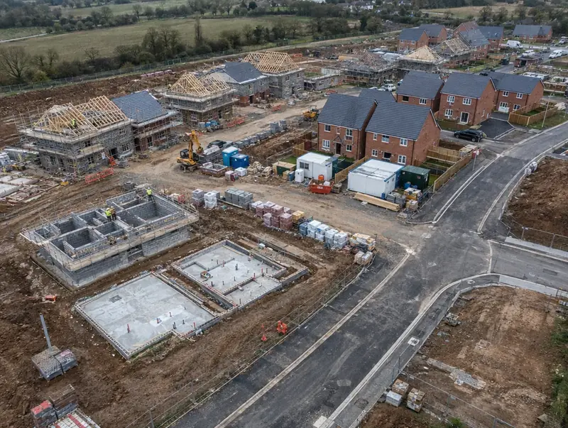 Tyldesley · M29
Free site appraisal
Tell us about your land and we will call you back. No cost, no obligation.
Prefer to talk? Call 0800 088 6248.
- Free site appraisalNo cost, no obligation
- Legal fees coveredReasonable fees, on options and promotion
- Nothing to pay upfrontOn promotion: we fund planning
- Direct purchaseSuitable sites, with or without planning
- UK-wideEngland, Wales, Scotland and NI
Planning and building around Tyldesley
In Greater Manchester, Tyldesley lies about 10 miles west of Manchester; its central postcode district is M29. Nearby, we also cover Atherton, Leigh and Walkden, all within 3 miles. Tyldesley is part of England’s North West region.
Typical work around Tyldesley: fields that need a masterplan before an application, land with an expired or ageing consent and sites where the layout needs to change. Planning in Tyldesley follows England’s rules: the National Planning Policy Framework sets national policy and the council’s Local Plan sets local policy.
Tell us about the site near Tyldesley and we will explain how we would take it forward.
Our approach in Tyldesley
Buildability checked
We test every scheme for construction cost and practicality, so the consent we seek is for homes that can actually be built and then sold or let.
Funded on promotion
Where we promote your land, the design work is part of the planning work we fund, recovered from the sale proceeds only if the land sells with planning.
Drainage and ecology built in
Sustainable drainage, biodiversity and tree retention shape the layout from the first sketch, rather than being squeezed in after the homes are placed.
Clear plans for landowners
We explain drawings in plain terms, so you can see how your land would be used, where the access runs and what land might be left over.
Planning in Tyldesley: the English rules
In England, most planning applications for new homes in Tyldesley are decided by the local planning authority, usually the council, using its Local Plan and the National Planning Policy Framework. Many landowners sell without planning, either outright or through an option or promotion agreement that funds the application first. Land to Homes offers a free site appraisal, pays your reasonable legal fees on option and promotion agreements, and can buy suitable sites directly, subject to survey, title and contract.
In England, the National Planning Policy Framework places strong weight on well-designed places, and the National Design Guide and National Model Design Code shape what councils expect. Many councils have adopted local design codes. Most applications must also deliver biodiversity net gain, which affects how much of a site is set aside for habitat.
| National planning policy | National Planning Policy Framework (NPPF), revised August 2026, with national planning practice guidance |
|---|---|
| Land transaction tax (paid by the buyer) | Stamp Duty Land Tax (SDLT) |
| Land registration | HM Land Registry |
| How a sale becomes binding | A land sale becomes legally binding on exchange of contracts and finishes on completion, after which the buyer registers the title with HM Land Registry. |
Your questions answered for Tyldesley
What is a design code?
A design code is a set of simple, measurable design rules for an area or a site, covering matters such as building heights, materials, street widths and green space. In England, councils are encouraged to produce design codes, guided by the National Model Design Code. Wales, Scotland and Northern Ireland use design guides and placemaking policies to similar effect.
How do you make new homes fit in with existing streets?
We study the scale, materials, building lines and spaces of the surrounding area and design homes and streets that respond to them. On a village edge that might mean lower density and more landscaping; in a town, homes that follow the existing street pattern. Early talks with planning officers and neighbours help shape the design.
What is a masterplan?
A masterplan is a drawing and supporting document that shows how a larger site will be laid out: where the homes, roads, footpaths, open space and drainage go, and how the site will be built in phases. It gives the council and the community a clear picture of the scheme before detailed designs are prepared for each phase.
How many homes could my land take?
It depends on the size and shape of the site, the access, the character of the area, the open space and drainage the scheme needs, and local planning policy on density. Sites of the same size can have very different capacities. A capacity study is the reliable way to answer the question, and our free site appraisal gives an indicative figure.
Can you manage a site in Tyldesley from planning to build?
On land we take forward ourselves in Tyldesley and elsewhere in Greater Manchester, including Ashton-under-Lyne, Chadderton and Eccles, we manage planning, design and construction. Tell us about the site and we will explain how we would approach it.
Read more: Architecture and Masterplanning · Guide: Planning permission explained for landowners